regenerative agriculture

Canarium commune - Canari, Java Almond, Kenari Nut

I'm pretty sure this is Canarium commune (photos below), a close relative of Canarium ovatum, the Pili Nut. I took this photo and collected seed from Summit Botanic Garden outside of Panama City in Central America where they also have a collection of Pili nut among many other interesting species from their earlier years as an experimental garden.  

dscf6228.jpg

Canarium commune, also known as Java Almond or Kenari Nut, is a tree native to Southeast Asia from Indonesia to New Guinea. 

USES and ETHNOBOTANY

The edible nut / kernal can be eaten raw or cooked and is prepared in a variety of ways. In its area of origin it is highly valued as a traditional snack. The nuts can be used as a substitute for the common almond.

Nuts can be ground into a powder and used to make bread. The seeds are used in a wide variety of dishes by the local people. The seed contains about 72% oil, 13% protein and 7% starch. Interestingly, it has been found that adding a strained emulsion of the crushed, ripe kernels to cows milk will make the milk much more digestible when fed to babies and infants. An edible oil is obtained from the seed which is preferred to coconut oil by local people where Java Almond is traditionally grown and consumed. 

An oil derived from Canarium commune is also used in the cosmetic and aeromatics industries called Elemi Oil. Elemi produces a bright lemony, woody fragrance with a hint of fennel, frankincense and grass. Elemi is known to be clarifying and cleansing with energizing properties. It stimulates mental ability and works well for morning meditation, tai chi or yoga exercises. It creates a spirit of hopefulness and is said to relieve depression.

Traditionally, people use elemi with substances that are refreshing and cleansing such as mastic, lemongrass, and sweet grass.

Elemi is also used topically to treat skin disorders and ulcers.

AGROFORESTRY

In agroforestry systems the tree is traditionally planted in nutmeg groves to provide shelter and shade and a secondary overstory crop. 

The tree and its various products have a  wide range of additional traditional uses. 

The Waru-Waru raised-bed agricultural systems of Los Llanos de Moxos, Bolivia

Note: Following are some sections I’ve extracted from a research paper I wrote some years ago, in 2006. This article should be read in conjunction with one I posted previously on the pre-Colombian chinampa raised bed hydrological agriculture systems.

 Waru-waru and the Domesticated Landscapes of Los Llanos de Moxos, Bolivia

Most of the lowland savannas in South America are seasonally inundated by overflowing rivers or standing rainwater. In the sense that there is a consistent source of water, these regions share some similarities with the lake basins and floodplains on which Mexico’s chinampas were constructed. One major difference is that whereas the chinampas in Valley of Mexico were endowed with perpetual spring-fed water, the raised-bed systems in lowland regions of Amazonia receive water once annually over the period of a long wet season.

The Beni savannas of Bolivia, Los Llanos de Moxos, provide another example of raised-bed wetland agriculture. This is a flat geographic region located at the southwestern headwaters of the Amazonian drainage basin and composed of very poor clay-pan soils low in organic matter, due to infertility there is little attempt to cultivate the region today. Nevertheless, aboriginal people in the Llanos de Moxos did cultivate the savanna, as is evident from the remnants of tens of thousands of ridges, drainage ditches, and raised platforms which provide ground above water and navigational canals for when the savannas were annually inundated  (Denevan, 1966b: 84-96). Not only is there ample evidence that these large, flat expanses were cultivated, but such practices were implemented on an intensive, year-round basis for thousands of years. A growing number of researchers believe the Beni once housed “some of the densest populations and the most elaborate cultures in the Amazon” (Mann 2000; Denevan 2001; Erickson 2001, 2006).

Up until recently the artificial earthworks and drainage features of the Llanos de Moxos had only been mentioned briefly. Oil explorations between 1958 and 1961 made available the first aerial photographs of the Moxo savanna, revealing the great extent and complexity of abandoned raised bed hydrological agriculture systems. These initial photos provided sufficient interest to spur on further investigation leading to more accurate estimations regarding the size, number and diversity of raised beds, causeways, irrigation canals and other landscape features (Plafker 1963; Denevan 1963).

Denevan (1966) was the first to provide detailed archaeological evidence that Palaeo-Indians made large-scale changes to the topography of much of the region, which allowed human habitation and food cultivation above the floodwaters. Denevan (1966) concluded that the basic vegetation patterns in the Llanos de Moxos savannahs have been determined by the degree of flooding, which is determined by local relief, but, perhaps most importantly he demonstrated that much of this relief was created by earthmoving activities of the pre-Hispanic peoples of the region. These populations permanently transformed regional ecosystems, creating what Clark Erickson ( 2005) has referred to as a “richly patterned and humanized landscape… one of the most remarkable human achievements on the continent”.

Some of the major elements that can be found in the artificial landscapes of the Beni include causeways, mounds of varying dimensions, a range of types and sizes of raised fields, canals, fish weirs, and circular ditches or moats. Abandoned remains are numerous and can be found throughout the Mojo savanna (Denevan 2001: 23-24; Erickson 2001: 23-25). The chronology for these various earthworks is limited, what evidence has been found indicates that that these societies have worked at modifying and maintaining their landscapes for at least the past three thousand years. All of these various forms of landscape engineering are indications that Moxos savannahs supported intensive fishing and farming industries, supplying, and maintained by, a much larger human population then that which exists in this part of Bolivia today (Maylle et al. 2006).

Clark Erickson has written that, beginning 3000 to 5000 years ago, cultures of the Beni savanna “erected thousands of linear kilometers of artificial earthen causeways and canals, large urban settlements, and intensive farming systems.” Originally Denevan estimated from aerial photographs that the raised field, canals and other earthworks of the region are estimated to cover an area of 77,000 square kilometers of land (Denevan 1966). However, based on more recent findings from ground surveys and enhanced satellite imagery, Erickson suggests that anthropogenic landforms cover a much larger area, demonstrating many raise fields are either under dense tree canopy or apparent only in faint traces often undetectable with the naked eye (Erickson, unpublished article).

Recent research from a variety of disciplines has steadily accumulated revealing more details and an altogether greater understanding of the Moxo savanna earthworks. The agricultural fields, or platforms, can vary greatly in terms of dimensionality but for the most part they were elongate and rectangular in shape, spaced anywhere from ten to a hundred feet apart and ranging from one to twenty five meters in width. Some of the larger fields extend to over three hundred meters in length. Smaller raised platforms typically occur in groups between several hundred and several thousand individual, sometimes interconnected, bodies. Interestingly while some fields are in parallel alignments, others angle off obliquely. These varying features have been interpreted as relating to the direction of natural flow of the water, or to unknown customs regarding sacred alignments. All in all there are tens of thousands of raise fields extending across the vast, flat landscape, highly indicative of large, well-organized populations (Denevan 1966: 85).

Circular mounds (lomas) are also common through the area, especially within peripheral gallery forests. The mounds have been variously interpreted as garbage piles, house mounds, ceremonial mounds or burial mounds. Linear ridges serving as causeways often radiate from mound sites, often connect mounds and forest islands. Based on the centrality of the mounds it is likely that they served as settlements, inhabited by up to a few thousand people. Judging by the overarching logic and intelligence behind the greater system it is unlikely that the populations produced and accumulated waste, as is typical of western cultures. Instead it appears as if waste was synonymous with building materials, fertilizers and other structural components. The composition of raised beds, causeways and fish weirs suggest that primarily “trash” served as a vital construction material (Erickson 2005: 235-267).

The causeways, which have been said to be one of the most spectacular features of Moxo landscapes, are thought to have performed multiple functions, for transportation, hydraulic control and as boundary markers. Major canals flanking either side of the causeways were most likely built both for transportation purposes and to regulate water levels within the system, diverting water to and from streams and rivers.  Other highly impressive earthworks discoveries are the many complex networks of linear zigzag structures that have been interpreted by Clark Erickson (2000) to have functioned both as levees and fish weirs, used seasonally to capture and contain both water and edible water fauna. Erickson has conducted the most extensive archeological studies in the area and conclusively interprets all major features of the landscape as anthropogenic due to their “unnatural” shapes and because they have been found to be constructed from an assortment of materials not typically found in the area, including rock, ceramic, sticks and basketry (Maylle et al. 2006).

When were these landscapes constructed? How long were they were used?  When were they abandoned? As of yet, none of these questions have been adequately answered, or empirically proven. Although, in regards to the latter question, as with the chinampas of Mexico, it is widely believed that the Conquest played a staring role in the demise and desertion of Moxo settlements. The Beni region of Bolivia was one of the last to be invaded and conquered. Local Indian populations were successful in building a reputation of ferocity thus deterring the European enemy for a time. There are a number of theories: one is that the extensive systems were preemptively abandoned in expectation of the imminent onslaught of ravenous Europeans. Under these circumstances it is thought that the many interconnected villages and societies would have necessarily fragmented, migrating to surrounding areas. Another possibility is that illnesses was brought to the continent by the Europeans, such as smallpox, which may have arrived to the Beni region before the Europeans did, effectively eliminating sufficient numbers of people to force abandonment. Interesting is the detail that the Beni savanna was pegged for a longtime as being a potential location of the fabled city of El Dorado. It is said that when the Spanish finally arrived to the region, upon seeing no golden paradise they promptly left, not to return for another few hundred years when in search of oil deposits (Mann 2000).

Edible / Condiment leaf species of Southeast Asia.

The following is a list of species whose leaves are used as condiments in Southeast Asia. The list is not, by any means, complete, but includes some of the lesser known, more obscure species.

Acacia farnesianaCassie flower, Leguminaceae

Achronychia laurifoliaKetiak, Rutaceae

Aegle marmelosBael fruit, Rutaceae

Allium odorumChinese chives, Liliaceae

Ancistrocladus extensus, Ox-tongue, Dipterocarpaceae

Antidesma ghaesembillaSekinchak, Euphorbiaceae

Begonia tuberosaTuberous begonia, Begoniaceae

Claoxylon polotRock blumea, Euphorbiaceae

Coleus tuberosus, African potato, Labiatae

Crypteronia paniculata, Sempoh, Lythraceae

Curcuma domestica, Turmeric, Zingiberaceae

Cymbopogon citratusLemon Grass, Graminae

Cyrtandra decurrens, Graminae

C. pendulaRock sorrel, Graminae

Dendrobium salaccenseCooking orchid, Orchidaceae

Derris heptaphyllaSeven finger, Leguminaceae

Elethariopsis sumatranaFrangrant gingerwort, Zingiberaceae

Eugenia polyanthaWhite kelat, Myrtaceae

Evodia roxburghianaSour-relish wood, Rutaceae

Gymura procumbens, Akar, Compositae

Homalomena graffithiiItch grass, Araceae

HornstedtiaTepus, Zingiberaceae

Horsfieldia sylvestrisPendarahan, Myristicaceae

Kaempferia galangaChekur (Galangal), Zingiberaceae

Kaempferia rotundaKenchur, Zingiberaceae

Leucas lavandulifoiaKetumbak, Labiatae

L. zeylanicaKetumbak, Labaiatae

Limnophila aromaticaSwamp leaf, Scrophulariaceae

L. villosa

L. conferta

L. pulcherrima

L. rugosa

Lycium chineseKichi, Matrimony vine, Solanaceae

Lycopersicum esculentumTomato, Solanaceae

Medinilla crispataMedinilla, Melastomataceae

M. hasseltii

M. radicans

Mentha longifoliaLongleaf mint, Labiatae

Murraya koenigiiCurry-leaf tree, Rutaceae

Nauclea esculentaPincushion, Rubiaceae

Ocimum canumHoary basil, Labiatae

Oenanthe javanicaShelum, Umbelliferae

Ottelia alismoides, Pojnd lettuce, Hydrocharitaceae

Oxalis corniculataSorrel, Oxalidaceae

Pilea melastomoidesSweet nettle, Urticaceae

Piper lolotPepper leaf, Piperaceae

P. caducibracteum

P. umbellatum

Pistacia lentiscusPistachio resin tree, Anacardiaceae

Pluchea indicaIndian sage, Comppositae

Polygonum hydropiperWater polygonum, Polygonaceae

Staurogyne elongataCross flower, Acanthaceae

Trachyspermum involucratumWild celery, Umbelliferae

Chinampas in the news - Mexico

Here is an interesting article about the current state of Mexico’s chinampas. For more articles on Chinampas and related agriculture / land management systems from this site search “chinampa” in the right-hand side bar (or click link). Here is a link to the original article quoted below.

Mexico’s Chinampas – Wetlands Turned into Gardens – Fight Extinction

By Emilio Godoy

Edited by Estrella Gutiérrez/Translated by Stephanie Wildes

Chinampa 1.gif

A farmer transports his freshly harvested crops from his chinampa – a rectangular garden on land reclaimed from the wetlands of Mexico City – along a canal in Xochimilco. But this age-old Aztec technique used to feed the local population is threatened by the encroaching city and by pollution. Credit: Emilio Godoy/IPS

XOCHIMILCO, Mexico , Feb 27 2016 (IPS) – David Jiménez grows two kinds of lettuce and other fresh produce on his “chinampa” or artificial island just under one hectare in size in San Gregorio Atlapulco, on the south side of Mexico City.

“We can get five or six harvests a year. Lettuce can grow in 30 days,” Jiménez, the president of the six-member La Casa de la Chinampa cooperative, told IPS with evident enthusiasm. The cooperative operates in Xochimilco, one of Mexico City’s 16 boroughs.

The ejido – land held in common by the inhabitants of a village and farmed cooperatively or individually – where Jiménez has his farm covers 800 hectares, and is home to 800 farmers who mainly grow vegetables. Half of the ejido is made up of chinampas.

The system of chinampas dates back to the Aztecs, long before the arrival of the Spanish conquistadors in the 15th century. The technique creates small, rectangular gardens reclaimed from Mexico City’s marshy lakebed by piling up soil on a mat of sticks, using wattle as fencing and willow trees at the corners to secure the bed.

The chinampas are rich in muck and decaying vegetation, which provide nutrients for the crops, while the ditches between them give the plants continuous access to water. As a result, the vegetables grown there are especially rich in nutrients.

The chinampas, which help feed the 21 million people who live in Greater Mexico City, are in the boroughs of Milpa Alta, Tláhuac and Xochimilco.

Worked by some 5,000 farmers, the chinampas cover a total of 750 hectares. The system is profitable, because they produce a combined total of around 80 tons a day of vegetables.

Each head of lettuce fetches 10 cents of a dollar, Jiménez said, as he tended to a row of lettuce.

The chinampas or “floating gardens” produce spinach, chard, radishes, parsley, coriander, cauliflower, celery, mint, chives, rosemary, lettuce and purslane or pigweed. Visitors to the area walk along paths that take them across a green carpet segmented into rectangles of crops and divided by the ditches of water they depend on to grow.

The drought-resistant system uses less water than traditional irrigation and produces fish, vegetables, flowers and medicinal herbs.

Studies also show that the chinampas repel pests, are more productive than conventional agricultural systems, and produce biomass. The technique is completely sustainable, retaining moisture and regulating the microclimate in the area.


David Jiménez, a local farmer, next to medicinal herbs grown on his land in San Gregorio de Atlapulco in the Mexico City borough of Xochimilco, where chinampas continue to survive – an age-old Aztec technique that creates farmland out of the local wetlands. Credit: Emilio Godoy/IPS

Ricardo Rodríguez, founder and director of the company De la Chinampa a tu Mesa (“from the chinampa to your table”), came up with a way to link traditional production techniques with new technologies, by marketing the vegetables grown on the chinampas over social networks.

He picks up fresh produce in the Cuemanco natural area in Xochimilco, signs up customers on his web page, processes the purchases, and distributes the orders to the customers’ homes.

“We help generate demand, which motivates them to keep farming. And this helps restore the chinampas. The market is starting to recognise the value of the chinampas,” Rodríguez told IPS.

The entrepreneur works with 22 “chinamperos” or chinampa farmers who grow broccoli, spinach, beets, radishes and other crops on approximately 15 hectares. He delivers some eight orders a day, weighing eight kg on average. His 450 registered customers include stores and restaurants that sell organic food.

Xochimilco, which is home to more than 415,000 people on some 125 sq km, was named a World Heritage Site by the United Nations Educational, Scientific and Cultural Organisation (UNESCO) in 1987.

In addition, the Ejidos de Xochimilco and San Gregorio Atlapulco Lake System have been on the Ramsar ConventionList of Wetlands of International Importance since 2004.

The U.N. Food and Agriculture Organisation (FAO) selected the chinampas as a Globally Important Agricultural Heritage System (GIAHS), because they preserve agricultural biodiversity, help farmers adapt to climate change, bolster food security and reduce poverty.

Marco Covarrubias, the head of the Gastronomy Centre at the private Claustro de Sor Juana University based in Mexico City, stresses the importance of the chinampas in terms of food production.

“The advantage is that they are in permanent contact with water, which unlike in other systems is not used to irrigate but is absorbed by the plants,” he told IPS. “And they have added nutritional value because a large part of the chinampas is free of pesticides and other agrochemicals.”

Urban sprawl and expanding slums, the use of pesticides, climate change, excessive use of groundwater, and neglect have all contributed to the destruction of the chinampas, says a study by the Natural and Cultural Heritage of Humanity Zone Authority (AZP) in Xochimilco, Tláhuac and Milpa Alta.

The AZP, created in 2014, is in charge of managing the preservation of this special ecosystem, in order to maintain the UNESCO and Ramsar Convention designations.

“Any effort to protect the area must take into account the local farmers and the cultural environment surrounding the chinampas. This is a culture that is not really appreciated, the restoration plans haven’t been carried out,” said Jiménez.

His cooperative decided to create a model farm on two hectares of their land, to show visitors the benefits of the chinampas.

And on Feb. 22, it launched a programme in local schools, which includes a virtual tour of the chinampas. With some 6,400 dollars in public funds, the idea is to raise awareness among 6,000 students in primary and secondary schools in Xochimilco.

The environmental authority is facing cuts, which have hurt its efforts to protect the region. Its budget shrank from 700,000 dollars in 2015 to 400,000 dollars this year. Since 2013, the AZP has supported 174 environmental and cultural improvement projects, but there is no clear information about the specific impact on the chinampas.

In March 2014, the French Global Environment Facility donated 1.65 million dollars for the conservation of the area.

In an October 2014 report, “Rehabilitation of the chinampera network and the Xochimilco native species habitat,” the Biology Institute of the National Autonomous University of Mexico said restoration of the chinampas should be a priority, because of their ecological, economic and social importance.

It recommended promoting the concept of chinampa-nature reserve, “because this represents multiple benefits for improving water conditions while giving a boost to sustainable productive activities as a strategy to prevent encroachment by urban sprawl.”

Covarrubias, meanwhile, said “Greater attention should be paid to the chinampera zone; it should be studied as an area of extremely high production potential, and a public policy should be created to link people who live in, and make a living from, the chinampas, with direct buyers.”

Since 2014, his university has organised the La Chinampería programme, to hook up local farmers and buyers. And this year it is carrying out another applied research plan to foment value chains, with the participation of 15 chinampa farmers.

“Awareness-raising programmes are needed for their descendants to start to recuperate the chinampas, improve the cleaning system, and acknowledge the farmers,” said Rodríguez, the entrepreneur, who organises “consciousness-raising tours” on the role of the chinampas in food security and the importance of small-scale local agriculture.

He wants to create a market of producers in Cuemanco, generate a label for goods produced in Xochimilco, to boost the prices of local products, and set up a collection centre for the products.

Edited by Estrella Gutiérrez/Translated by Stephanie Wildes

Lecythis minor (syn. L. elliptica) - Coco de Mono

Lecythis spp. mini Brazilnut.jpg

This is a fantastic tree with much potential for further dissemination and integration into agroforestry and regenerative agricultural systems.

I first encountered the species growing in a stand of three trees in a somewhat neglected area on the edge of Summit botanic gardens outside of Panama City. I have collected seed from these trees for years. A cream colored aril is attached to the end of each nut, the aril tastes like anise but I’m not entirely sure if its edible. The nut itself is one of the best tasting tropical nuts I have eaten, identical in taste to its close relatives L. zabucajo and Brazil Nut (Bertholletia excelsa).

ORIGIN AND DISTRIBUTION

Lecythis elliptica fruit

Ranges from the Maracaibo lowlands of Venezuela to the northern coast of Colombian where it ascends to the Magdalena and Cauca valleys. The species most often occurs in dry, open, somewhat disturbed habitats where it grows as a much branched tree, however it can also be found growing in moister forests, especially along waterways where it reaches heights of 25 m. 

USES AND ETHNOBOTANY

Lecythis elliptica fruit.jpg

The tree is primarily cultivated from seed for its nut, which can be eaten fresh or roasted. The seedpod and nut are like smaller versions of the closely related L. zabucajo. The nut has a superior flavor and a high oil content. In Brazil, an oil is extracted from the nuts to make soap.

PROPAGATION AND CULTIVATION

The tree is easily propagated from seed, although this species has never been systematically cultivated for commercial purposes. It is an underutilized crop that warrants further experimentation and research for incorporation into tropical agroforestry systems. 

Lecythis elliptica tree.jpg

Gustavia superba - Membrillo

ORIGIN AND DISTRIBUTION

Gustavia superba, or Membrillo, is a tree with origins in tropical lowlands from Ecuador to Panama and Venezuela. It is mostly found in homegardens grown for personal consumption. 

Gustavia superba fruit 1.jpg

USES AND ETHNOBOTANY

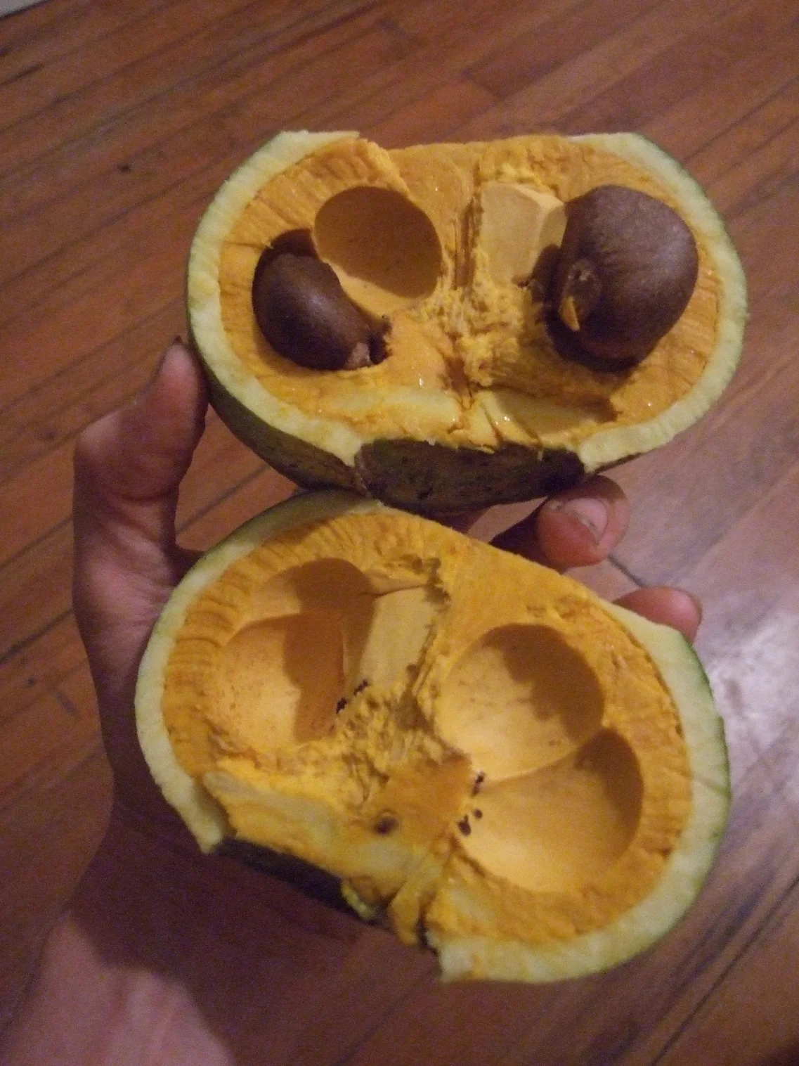
The rounded, pear shaped fruits appear on the trunk contains one to four large smooth light brown seeds are surrounded by a fleshy edible orange pulp, which is typically boiled and is said to have a taste resembling meat.Membrillo pulp is rich in vitamins A, B, and C.

PROPAGATION AND CULTIVATION

Gustavia superba fruit.jpg

The tree can be propagated easily from the seeds found embedded in the edible pulp. The tree is generally slow growing, likes water and sun, and can reach a height of five to ten meters. The species is adapted to hot, humid, tropical climates and will do best in well drained soils with full sunlight. The leaves of G. superba are a favorte food of iguana.

Lecythis zabucajo - Monkey Pot

DSCF7160.jpg

DESCRIPTION, ORIGIN AND DISTRIBITION

Monkey Pot, or Olla del Mono, is a term to describe not only L. zabucajo, but a number of other closely related species, including: Lecythis ellipticaLecythis grandiflora, and Lecythis pisonis.

All of the Monkey Pot species are native to the humid tropical forests of northern South America, from Colombia to Brazil. They have been introduced on a small scale to a number of countries with similar climates around the world.

The trees are of varying sizes. Lecythis elliptica is smaller with spreading branches, the others can reach heights of over 35 meters, also with a spreading canopy, also about 35 meters, if not more.

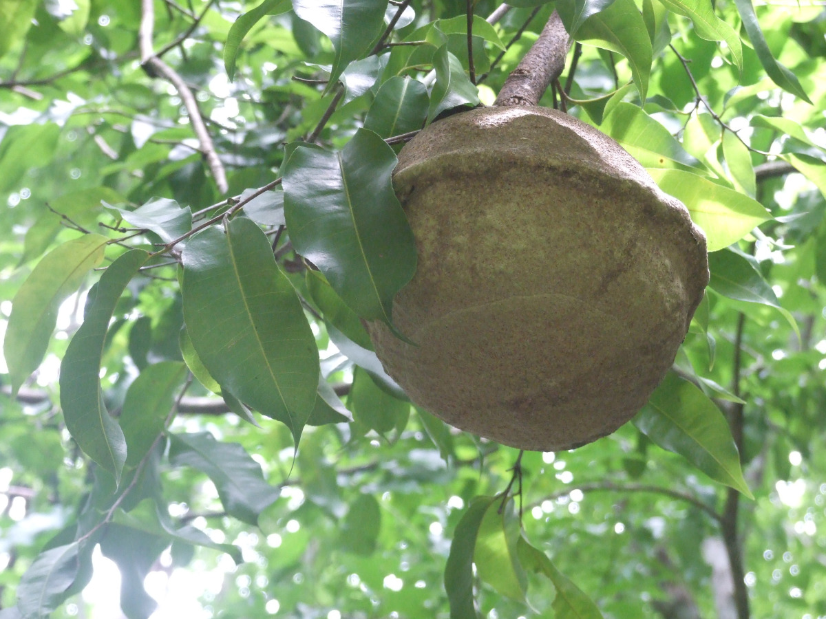
There are a few old L. zabucajo trees in a stand where I collected seed, remarkably wide canopy, close to sixty feet I would say. The branches arc up and out until they almost touch the ground. Typically, one can locate an open pod and merely walk around beneath it and find seed. However, the agouti forage for nuts in these trees and will chew through the woody pod to extract them. So I had to climb up the end of a branch and hang precariously  while pulling on a rope tied around a higher branch holding the fruit, then clip the 3/4 inch stem.

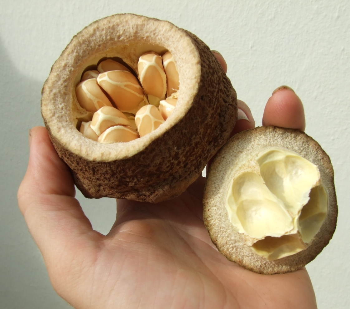
The large woody fruit of L. zabucajo.

The large woody fruit of L. zabucajo.

The photos below are from that stand. The last two photos are from a smaller fruit from a smaller tree, but larger than L. elliptica. I’m not sure if it was just a smaller L. zabucajo tree or another species.

The fruit is a roundish and woody with a cap that pops off when it’s reached maturity. Inside are anywhere from 8 – 40 seeds (depending on the species) which fall from the woody capsule after a period of time.

USES AND ETHNOBOTANY

This species is closely related to the Brazil nut, both belonging to the family Lecythidaceae and having coconut-sized fruits. The tree's large woody gourd-like fruits with edible white flesh are used for water vessels and for ornamental purposes. The fruit is called 'monkey pot', a name used for a number of other species, including Lecythis ellipticaLecythis grandiflora, and Lecythis pisonis. The name is said to derive from baiting an empty fruit with food and fixing it to a low branch; a monkey can easily insert its paw through the opening, but cannot withdraw it once it has grasped the contents.Although they are little known outside their area of origin, the nuts produced by these species are among the best in the world, equal or superior in flavor to the Brazil Nut. There is a cream colored arial attached to the end of each seed. On numerous occasions I have tried it, it has a sweet licorice-like flavor although I was once told it has psychoactive properties. The tree wood is also of high quality.

PROPAGATION AND CULTIVATION

Lecythis zabucajo open pod

The Monkey Pot (Lecythis species) require a hot, humid climate. Deep, well drained soils are preferable. The young trees will also benefit from a shady environment in their first few years of growth.

Trees are propagated by seeds, which will germinate in anywhere from 2 weeks to 4 months. In my experience, fresher seed will germinate faster. Initial growth is fast, a young tree can reach a meter in height in its first year. Trees are typically spaced 8 – 10 meters apart in single species plantations or groups. They can also be integrated into mixed species agroforestry systems as a long lived overstory / canopy tree..